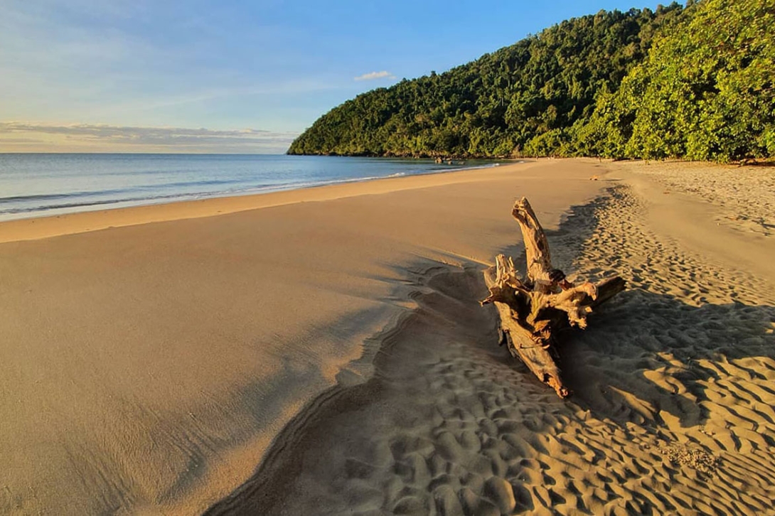
The Reef’s mainland coastline spans approximately 2300 kilometres of the Queensland coast. This assessment considers a range of coastal types including sandy beaches, rocky shores, estuaries, and tidal flats. The Region’s mainland beaches and coastlines have aesthetic value and are readily accessible, providing an array of recreational opportunities that contribute to the local economy. Mainland beaches support seabird and turtle nesting as well as important migratory shorebird habitat.101,102 They also include many sites of cultural and spiritual significance to the Reef’s Traditional Owners.

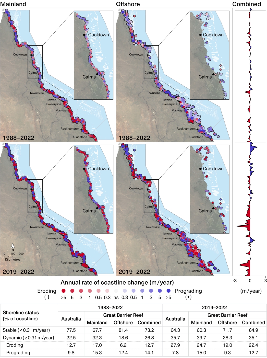
The Region’s coastline is monitored to measure shoreline trends, erosion and hazard lines, beach fluctuations, and storm demand (the removal of sand from beaches during storms).103 Many factors contribute to the complex equation of whether a particular beach will recede or grow.104 In general, beaches that are receding have a deficient supply of coarse sediments, such as sand and shingle, while other beaches build seaward where there is abundant supply of these sediments from the adjoining nearshore zones.103 Understanding of the movement of mainland beaches and coastlines at scale has advanced considerably since 2019 with the availability of new data sources, improved remote sensing techniques, and increased computing power for analysis.105,106 Analysis of satellite images shows that mainland coastlines within the Region have been less stable in the past few years (2019 to 2022) than the long-term average (1988 to 2022).99 These changes are largely driven by higher recent rates of coastal erosion, possibly linked to the influence of La Niña conditions on wave direction.107 Compared to the long-term average, the most significant coastal changes have occurred within the mainland Townsville–Whitsunday management area (Figure 2.3).99
Understanding of coastline movements has advanced considerably since 2019
Figure 2.3
Rates of coastline change relative to 2022
Top: Annual rates of coastal change (metres per year) relative to 2022 for all Digital Earth Australia (DEA) coastline positions within the Region for the period 1988 to 2022, mapped separately for mainland and offshore coastlines. The combined summary plot shows the mean annual rate of change at 30-metre intervals of latitude. Middle: The same analysis, for 2019 to 2022. Bottom: This table shows a greater proportion of coastlines were dynamic (predominantly due to erosion) from 2019 to 2022 compared to the full time series (1988 to 2022). Source: Analysis by Geoscience Australia 99 using Version 2.1 DEA Coastlines product and following methods described in Bishop-Taylor et al. (2021)108

While most beaches remain resilient at present, sea level rise is slowly intruding on estuaries and low-gradient shores and is expected to begin affecting beaches in the coming decades.103 This effect is not expected to occur uniformly across the Region. Local changes are likely to be further complicated by coastal development and associated changes in freshwater and coarse sediment dynamics.109
Non-rocky coastlines remain dynamic. Observed changes over recent years are likely to predominantly reflect natural variation in climatic and oceanic influences, but sea-level rise is expected to increase rates of erosion, recession and inundation in coming decades.


