2.3.3 Mangrove forests

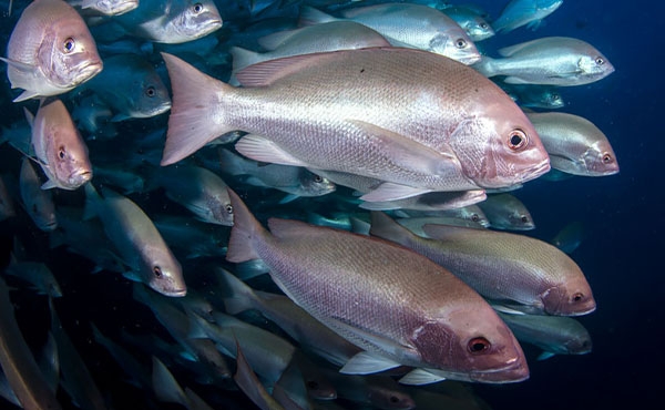
Mangrove forests are specialised plant communities with canopies of trees or shrubs, adapted to cope with the salty, oxygen-limited soils of the upper intertidal zone. These forests cover an area of approximately 2387 square kilometres in the Region.110 The Region’s mangrove forests are diverse on a world scale and support a high biodiversity of associated species, dominated by invertebrates (crustaceans, worms, molluscs, and other benthic animals) and fishes.111 They are important to the cultural heritage of First Nations peoples, who have made use of these abundant natural resources for thousands of years.112 Mangrove forests are an integral component of a mosaic of coastal ecosystems, including estuaries, seagrass beds, and saltmarshes (Section 3.5.1), that provide ecologically and economically important linkages between terrestrial and marine environments.113 While the connections between mangrove forests and fisheries are complex, these habitats are known to play a crucial role in providing food, shelter, and breeding grounds for species of commercial and recreational fishing value, such as bream, mullet, mangrove jack, barramundi, and prawns.114 

Mangrove forests also provide a range of ecosystem services, including coastal stabilisation storm buffering, filtration of land-based runoff, nutrient cycling and export to marine ecosystems, primary production, and carbon sequestration.36,115,116 As ‘blue carbon’ ecosystems, their capacity to accumulate and store organic sediments makes them important carbon sinks, contributing to the net removal of carbon dioxide from the atmosphere.117,118 It has been estimated that every hectare of mangrove wetland stores about 550 tonnes of carbon.36

Mangrove forests provide vital ecosystem services including carbon sequestration 

Mangrove forests continue to occupy most of their historical extent,110 although coastal development and natural processes have led to both losses and gains through time.119,120 Coastal developments including berms, ponded pasture, dams, seawalls, and roads on coastal plains, can lead to loss or degradation of mangroves and associated wetlands 121 (Section 6.4). Historical removal is a common legacy issue on degraded agricultural land, presenting opportunities for carbon capture through restoration in these areas.122 Although overall extent has changed little since 2015,110 expansion of mangroves has been observed in low wooded islands of the Howick Group in the northern Great Barrier Reef. This expansion equates to 10,233 tonnes of new mangrove biomass since the 1970s and is thought to be a consequence of changing environmental controls including relative sea-level rise over the past century.123 The ability of mangrove forests to keep pace with rising sea levels is limited.124 

Climate change is an increasing threat for mangrove forests, with sea level rise and coastal squeeze expected to impact mangrove forests in future decades (Section 6.3.2). Cyclone impacts generally remained low since 2019, though the impacts of cyclones in late 2023 and early 2024 have not yet been quantified. Evidence that greater damage after severe cyclones proportionately impedes recovery processes 125 suggests that future return intervals for severe cyclones will be a key determinant of future trends. Since 2019, important advancements in reporting on condition of mangrove forests include incorporation of a satellite-derived canopy-cover index 126 into the National Ocean Ecosystem Account.127 Mangrove condition indexes have also been incorporated into the Reef 2050 Regional Report Cards.128,129 The condition of mangrove forests across the Region is considered good, with an overall stable trend between 2005 and 2021.130 

Little change has occurred to the overall extent of mangrove forests. Gains and losses are occurring due to natural and anthropogenic processes. Evidence regarding the Reef-wide distribution and individual causes of these changes is currently limited. Acute cyclone impacts were relatively low from 2019 to 2023, but the impacts of successive cyclones during the 2023–24 wet season have not yet been assessed. Mangrove forests have expanded on some islands in the northern Great Barrier Reef.

References
  • 36. Queensland Museum 2022, Wetlands of Queensland: Queensland Museum discovery guide/published in partnership with the Department of Environment and Science, South Brisbane.
  • 110. State of Queensland (Department of Environment Science and Innovation) 2023, Biodiversity status of pre-clearing and 2021 remnant regional ecosystems - Queensland series, Version 6.13 edn.
  • 111. Joyce, K. 2006, Wetland Management Profile: Mangrove Wetlands, Department of Environment and Science.
  • 112. Michie, M. 1993, The use of mangroves by Aborigines in northern Australia, Channel Island Field Study Centre Occasional Paper (No. 5).
  • 113. Kanno, S., Heupel, M.R., Sheaves, M.J. and Simpfendorfer, C.A. 2023, Mangrove use by sharks and rays: a review, Marine Ecology Progress Series 724: 167-183.
  • 114. Kitchingman, M.E., Sievers, M., Lopez-Marcano, S. and Connolly, R.M. 2023, Fish use of restored mangroves matches that in natural mangroves regardless of forest age, Restoration Ecology 31(1): e13806.
  • 115. Wells, S. and Ravilious, C. 2006, In the front line: shoreline protection and other ecosystem services from mangroves and coral reefs, UNEP/Earthprint.
  • 116. Duke, N.C. 2006, Australia's Mangroves: The Authoritative Guide to Australia's Mangrove Plants, University of Queensland, Brisbane.
  • 117. United Nations Educational, Scientific and Cultural Organization 2024, Blue Carbon, <https://www.ioc.unesco.org/en/blue-carbon>.
  • 118. Bouillon, S., Rivera-Monroy, V.H., Twilley, R.R. and Kairo, J.G. 2009, Mangroves, in The Management of Natural Coastal Carbon Sinks, eds D. Laffoley and G. Grimsditch, IUCN, Gland, Switzerland, pp. 53.
  • 119. Hagger, V., Worthington, T.A., Lovelock, C.E., Adame, M.F., Amano, T., et al. 2022, Drivers of global mangrove loss and gain in social-ecological systems, Nature Communications 13(1): 6373.
  • 120. Barker, B. and Lamb, L. 2022, Wunjunga midden: Late Holocene change, site preservation and open midden sites on the Central Queensland Coast, Australian Archaeology 88(3): 318-327.
  • 121. Chamberlain, D., Phinn, S. and Possingham, H. 2020, Remote sensing of mangroves and estuarine communities in central Queensland, Australia, Remote Sensing 12(1): 197.
  • 122. Rowland, P.I., Hagger, V. and Lovelock, C.E. 2023, Opportunities for blue carbon restoration projects in degraded agricultural land of the coastal zone in Queensland, Australia, Regional Environmental Change 23(1): 42.
  • 123. Hamylton, S., Kelleway, J., Rogers, K., McLean, R., Tynan, Z.N., et al. 2023, Mangrove expansion on the low wooded islands of the Great Barrier Reef, Proceedings Royal Society B 290(2010): 20231183.
  • 124. Saintilan, N., Khan, N.S., Ashe, E., Kelleway, J.J., Rogers, K., et al. 2020, Thresholds of mangrove survival under rapid sea level rise, Science 368(6495): 1118-1121.
  • 125. Duke, N.C., Canning, A.D. and Mackenzie, J.R. 2024, 15. More Intense Severe Tropical Cyclones in Recent Decades Cause Greater Impacts on Mangroves Bordering Australia’s Great Barrier Reef, in Oceanographic Processes of Coral Reefs. Physical and Biological Links in the Great Barrier Reef, eds M. Kingsford and E. Wolanski, CRC Press, Boca Raton, Florida, pp. 226-252.
  • 126. Lymburner, L., Bunting, P., Lucas, R., Scarth, P., Alam, I., et al. 2020, Mapping the multi-decadal mangrove dynamics of the Australian coastline, Remote Sensing of Environment 238: 111185.
  • 127. Department of Climate Change Energy the Environment and Water 2024, National Ocean Ecosystem Account, Commonwealth of Australia, <https://eea.environment.gov.au/accounts/ocean-accounts/national-ocean-ecosystem-account>.
  • 128. Wet Tropics Waterways, 2. 2023, Wet Tropics Report Card 2023 reporting on data from July 2021 to June 22. Waterway Environments: Results, Wet Tropics Waterways and Terrain NRM, Innisfail.
  • 129. Healthy Rivers to Reef Partnership Mackay-Whitsunday-Isaac 2023, The Mackay-Whitsunday-Isaac 2022 Report Card (reporting on waterway health data collected between July 2021 and June 2022).
  • 130. McKenzie, L., Pineda, M., Grech, A. and Thompson, A. 2024, 2022 Scientific Consensus Statement: Summary | Evidence Statement for Question 1.2/1.3/2.1: What is the extent and condition of Great Barrier Reef ecosystems, and what are the primary threats to their health? in 2022 Scientific Consensus Statement on land-based impacts on Great Barrier Reef water quality and ecosystem condition, eds J. Waterhouse, M. Pineda and K. Sambrook, Commonwealth of Australia and Queensland Government.